The Stats
| Size | 1/4 acre |
| Trails | None, but the Mid-State Trail runs through it |
| Parking | Dirt lot, severely rutted when we visited |
| Toilet facilities | None |
| Town | Princeton |
| Trustees Region | Central MA |
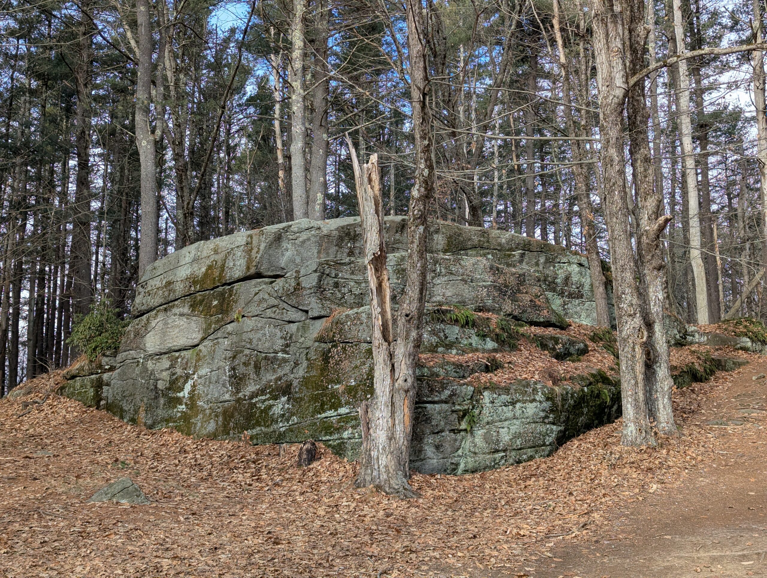
| Notable Item | Rock |
The Background
Redemption Rock is a key location in one of the 17th century’s hottest nonfiction books. If you haven’t read The Narrative of the Captivity and Restoration of Mrs. Mary Rowlandson … well, neither have we. (But you can download it for free from Project Gutenberg!) This spot is the location of the climax of the story.
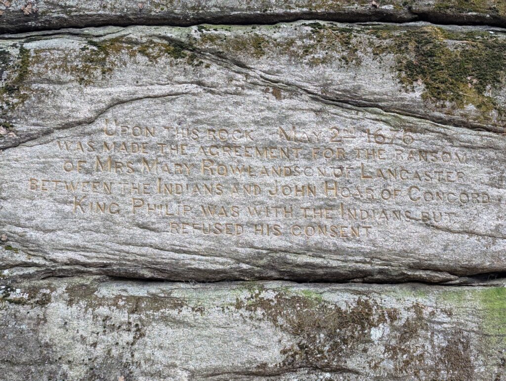
Mary Rowlandson was captured in 1676 during what colonists called King Philip’s War (also known as Metacom’s Rebellion), when Native Americans fought (unsuccessfully) to stop white colonists from taking their land. (To learn more about what led to the war, and its outcomes, read This Land is Their Land by David J. Silverman.) Several months later, colonists ransomed her from the Native Americans that had captured her. This rock was the spot where the exchange took place.
If you thought the name was Biblical, it appears to hew more closely to a different definition: “recovery of something pawned or mortgaged.”
Our Visit
We decided to start our Trustees journey on January 5, 2025 with what is probably the smallest property in the system, on a cold and blustery day. Not the most ideal conditions for a rocky promontory that catches a lot of wind!
As we faced the rock, to the right is an information board from the Trustees. Some of the text has been thoughtfully edited by a later visitor using marker. There is also a QR code on a tree that leads to a historical overview by the Princeton Historical Society. That overview is informative and provides more detail, although it definitely takes the Colonial point of view.
As we followed around to the left, we discovered a hard-to-read inscription on the rock. (Perhaps on a sunny day it would be easier.) It’s not clear when it was engraved, but based on the typeface I would think sometime between the 1860s and 1880s would be a good guess.
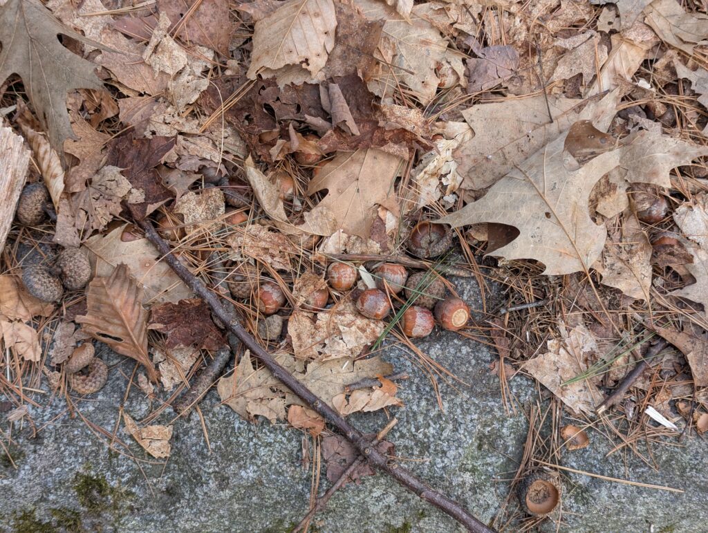
If you walk to the top of the rock alongside the left-hand side of the rock, beware the acorns. They are in piles, many are hidden under leaves, and they will absolutely roll under your foot. It made for a couple of extremely wobbly moments.
The Midstate Trail hiking trail runs right past Redemption Rock, so it could be a good spot if you wanted to get a bit of hiking in beyond the Trustees property. There is also a nice view of Wachusett Lake nearby, if you follow the Midstate Trail towards Redemption Rock Trail (which is not a trail, but instead an alternate name for Route 140).
While it may be in the woods now, a photo from 1879 shows a very different landscape. Some of that scrub brush up top may be today’s tall trees.

Leave a Reply